Project areas
Rotes Luch
CURRENT INFORMATION ON THE PEATLAND AREAS
Please click on the peatland area you would like to learn more about.
CONTACT PARTNER
Stefan Rätzel
E-mail: stefan.raetzel@nagolare.de
Telephone: 0173/ 712 88 34
AREA DESCRIPTION
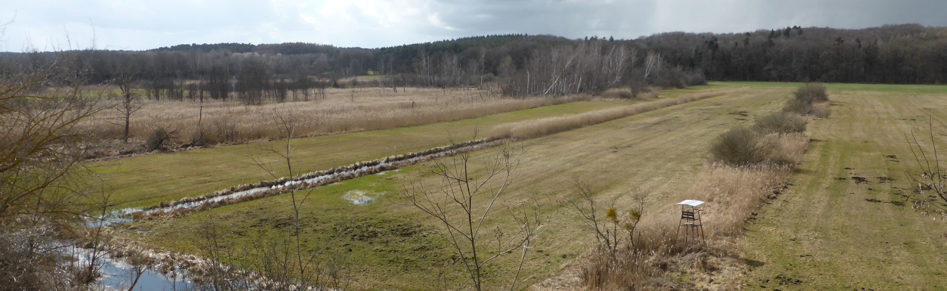
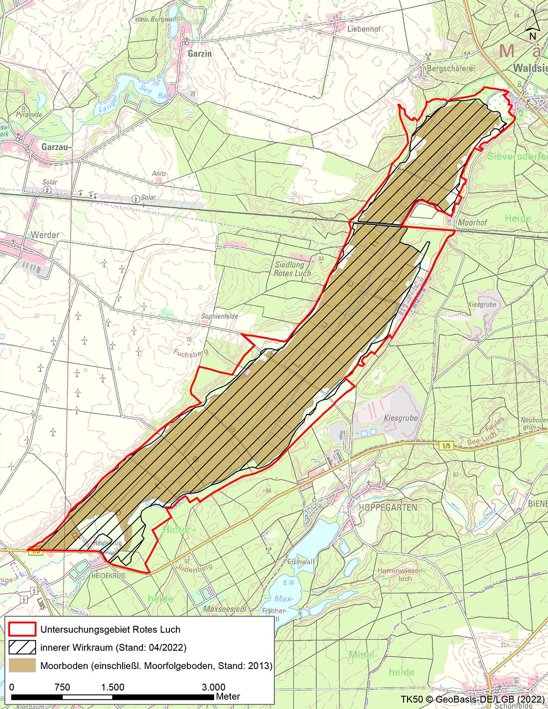
The Rote Luch is the largest low-lying peatland in East Brandenburg in the area of a valley watershed between the North Sea and the Baltic Sea. The Stöbber river rises at this valley watershed and flows off in two opposing directions. Embedded between the adjacent moraine plates Barnim and Lebus, a constant groundwater current from the peatland peripheries passes through the Rote Luch in the direction of the valley channel (Stöbber). As such, the Rote Luch may be classified as a hydrogenetic mire of the throughflow type. The throughflow mire has evolved on a marshy and silted-up mire.
Drainage of the area began as early as 1700. In the 19th century in particular, peat was frequently extracted from the Red Lyn, whose usable peat reserves were estimated at 16 million m³. Extensive melioration, especially of the southern part, took place between 1915-1923. Essentially, inland channels with a spacing of ca. 40m were created in the south-eastern areas. In 1957-1959, the existing channel system was further expanded and the Stöbber river was shaped in an attempt to regulate the water runoff in the area. This is evidenced by almost 200 culverts and dams in the area, many of which are no longer used today.
(Sources: Welker 1995, MLUK Brandenburg 2020).
The black grouse (Lyrurus tetrix), which is now extinct in Brandenburg, was still found in the Luch as a very significant supra-regional feature until the 1930/40s.
The Rote Luch is potentially a very suitable development area, especially for limicolas (plovers), due to its extent, location in the area and its extensive use as permanent pastureland. Currently, however, only remnants of a once rich limicole world remain. Reasons for this include the water levels in large areas of the Luch, which are usually very low over long periods of the year, and the predominantly intensive early first cutting dates and frequent rolling of the areas in spring.
In the peripheral zones of the project area, there are still small areas of biodiversity in wet meadows, with occurrences of meadow orchids, for example.
WHAT IS CURRENTLY HAPPENING?
Hydrological measurements at six groundwater monitoring sites and one surface water monitoring site
Mapping of the avifauna
Consultations with users
TASKS
Establishment of utilisation chains
Specific business analysis with regard to the need for adaptation for individual agricultural enterprises
Information event for owners
LATEST NEWS AND LINKS
This section contains the presentations of the early information event for owners in the Rotes Luch project area on 16.09.2022
- Presentation Dr. Lukas Landgraf
- Presentation Christina Grätz / Stefan Rätzel
- Presentation Dr. Kristina Brust
- Event notification Rotes Luch
COMPLETION STATUS
Please refer to the table for the completion status of the task using this Link.
Completion of project modules 1. and 2. is planned for 2022 and 2023. The project modules listed below are to follow:
- Validation of the development scenarios
- Approval procedure
- Project implementation