Project areas
Uckertal Süd
CURRENT INFORMATION ON THE PEATLAND AREAS
Please click on the peatland area you would like to learn more about.
CONTACT PARTNER

Stefan Rätzel
E-mail: stefan.raetzel@nagolare.de
Telephone: 0173/ 712 88 34
AREA DESCRIPTION
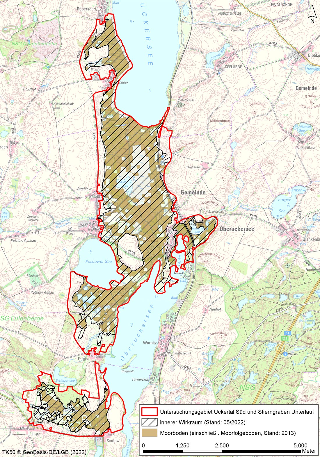
The study area is divided into two sub-areas: “Uckertal-Süd” and “Stierngraben”, which lie to the south of the town of Prenzlau.
The “Uckertal-Süd” area, with a surface area of 1600 ha, includes the area between the two Uckersee lakes (Ober- and Unteruckersee) as well as the marsh areas between Röpersdorf and Zollchow around the south-west shore of Unteruckersee, the marsh area around Krummesee lake east of Seehausen and the marsh areas south of Potzlower See lake.
The “Stierngraben” area, with a surface area of 223 ha, is concentrated on the marshy areas around the lower reaches of the Stierngraben watercourse, bordered to the south by the connecting road between Flieth and Suckow, and to the west by the Oberuckersee lake. The northern boundary of the area runs between Wrietzensee and Stierngraben and the eastern boundary slightly north of Flieth.
The Uckertal-Süd area is a large siltation marsh area in a complex with parts of throughflow mire on the sloping peatland peripheries and spring mire.
The Stierngraben area comprises the estuary area (lower reaches) of the Stierngraben into the Oberuckersee. Its character is more that of a marsh. Parts of spring and throughflow mires were however also addressed.
The entire low-lying area between the Oberuckersee and Unteruckersee lakes has been influenced by humans (drainage, mill water impoundment, lake level regulation, etc.) for over 1000 years. The Stierngraben area is also criss-crossed by drainage channels. The pure peat thickness varies greatly throughout the area and is up to 4 m thick in places. The greatest peat thicknesses are found in the peripheral areas of the Uckertal.
Drainage structures were already in place in the Stierngraben area before the 19th century. Both areas, however, commenced their main drainage activity at the end of the 19th century. The melioration plants fell into disrepair during and after the Second World War. In 1948, the peatlands between the lakes of Ober- and Unteruckersee were surveyed again. Beginning in the 1960s, the drainage of the land was further intensified and enhanced. It was never possible to drain the central part of the Uckertal between the lakes in such a way that pastureland use was possible. As a result, the morphological and hydrological conditions in this area mean that the marsh has largely retained its original condition.
(Sources: G. Lutze, H. DOMNICK (Hrsg.), 2017, Beyrow 2004)
Parts of the project area also belong to the Schorfheide-Chorin Biosphere Reserve. This area currently occupies a prominent position in Germany in matters of natural resources. The existing habitats in the reeds and species-rich pastureland and still quite extensively preserved peatland are of outstanding importance as migratory bird habitat, but also for breeding birds such as bitterns (Botaurus stellaris) and snipes (Gallinago gallinago). The Uckersee lakes area is also potentially classified as a development habitat for the Aquatic Warbler (Acrocephalus paludicola), which is currently considered “extinct” in Germany.
The area is an important habitat for the FFH species fish otter (Lutra lutra). The Ucker waters also have a unique species composition in Germany, e.g. crustaceans, which is still relatively little affected by neozoa, i.e. alien species.
The project area is also of botanical importance throughout Brandenburg and indeed for Germany. Several vascular plants of the highest endangerment categories “Endangered” and “Critically Endangered” are still to be found here.
A very special feature here is the halophilic moss Hennediella heimii , which is restricted to areas known as “salt patches”. The project area also contains important occurrences of two plant species that enjoy very special, Europe-wide protection under the Habitats Directive. These are the creeping marshwort (Helosciadium repens) and the marsh angelica (Angelica palustris). The largest populations in Germany of the latter species are found in the Ucker region.
WHAT IS CURRENTLY HAPPENING?
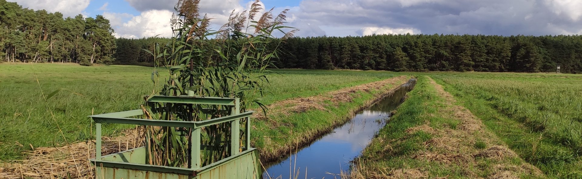
Hydrological measurements at six groundwater monitoring sites and one surface water monitoring site
Mapping of the avifauna
Consultations with users
TASKS
Establishment of utilisation chains
Specific business analysis with regard to the need for adaptation for individual agricultural enterprises
Information event for owners
LATEST NEWS AND LINKS
This section contains the presentations from the early information event for owners in the Uckertal South / Stierngraben project area on 19.08.2022.
- Presentation Dr. Lukas Landgraf
- Presentation Stefan Rätzel
- Presentation Dr. Andreas Wahren
- Event notification Uckertal
COMPLETION STATUS
Please refer to the table for the completion status of the task using this Link.
Completion of project modules 1. and 2. is planned for 2022 and 2023. The project modules listed below are to follow:
- Validation of the development scenarios
- Approval procedure
- Project implementation